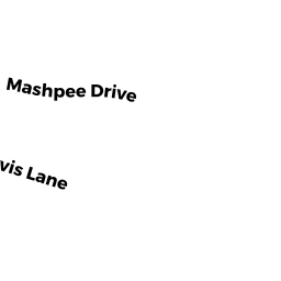
12 MASHPEE DR
Owner Information
BEAUVAIS MICHAEL J
12 MASHPEE DR
N ATTLEBORO, MA 02760


Property Details
12 MASHPEE DR is classified as a Single Family Residential (Ranch).
The primary structure on this property was built in 1992. There are 3,389ft2 of built area within this property. There is 1,324ft2 of residential/living space within this property. This property is listed as having 7 rooms.
12 MASHPEE DR is valued at $421,500. The land is valued at $156,700 and the structures are valued at $262,000. There is an additional valuation of $2,800 on this property.
The most recent deed for 12 MASHPEE DR is recorded at the local registrar in Book 24830, Page 0235. 12 MASHPEE DR was last sold on Wednesday, December 5, 2018 for $389,900.
Assessment data from fiscal year 2022.
Flood Data
According to the FEMA National Flood Hazard Layer, this property does not appear to be in a flood zone. It may also be in an area not yet reviewed. Nonetheless, confirm this information prior to taking any action.
To view the flood hazards around this property, create a FEMA "Firmette" Map of the area around 12 MASHPEE DR.
Broadband Internet Providers
| Provider | Type | Bandwidth (mbps) | |
|---|---|---|---|
| Verizon New England Inc. | DSL | 5 | 0 |
| VSAT Systems, LLC. | Satellite | 2 | 1 |
| HughesNet | Satellite | 25 | 3 |
| GCI Communication Corp. | Satellite | 0 | 0 |
| Comcast | Cable | 1000 | 35 |
| Verizon New England Inc. | Fiber | 940 | 880 |
| Viasat Inc | Satellite | 100 | 3 |
Broadband service provider data from December 2020.
Adjacent Properties
- 12 JARVIS LN
Single Family Residential owned by HEBERT CHRISTOPHER + SHAW CAILA - 260 CUSHMAN RD
Single Family Residential owned by MICHELSON BRETT A + DIAZ MALLORY E - 2 MASHPEE DR
Single Family Residential owned by IRUNGBAM SHASHIKANTA + ROMILA - 22 MASHPEE DR
Single Family Residential owned by GINGRAS JEFFREY A + ROBIN L